
Even more than 70 years after the end of the war, there are still numerous explosive ordnance sites underground in the Federal Republic of Germany. These pose a considerable risk to the protected interests of public safety or public order. In addition to written sources, historical aerial photographs in particular are an essential medium for reconstructing and spatially delimiting areas potentially contaminated with explosive ordnance.
In the context of aerial photo evaluation, there are always new, unknown or even curious things to discover in addition to the familiar image contents such as bomb craters or positions. Such image contents, some examples of which are presented below, also cause astonishment, initial confusion or, at best, even amusement in the everyday work of the "professionals" at Mull und Partner.
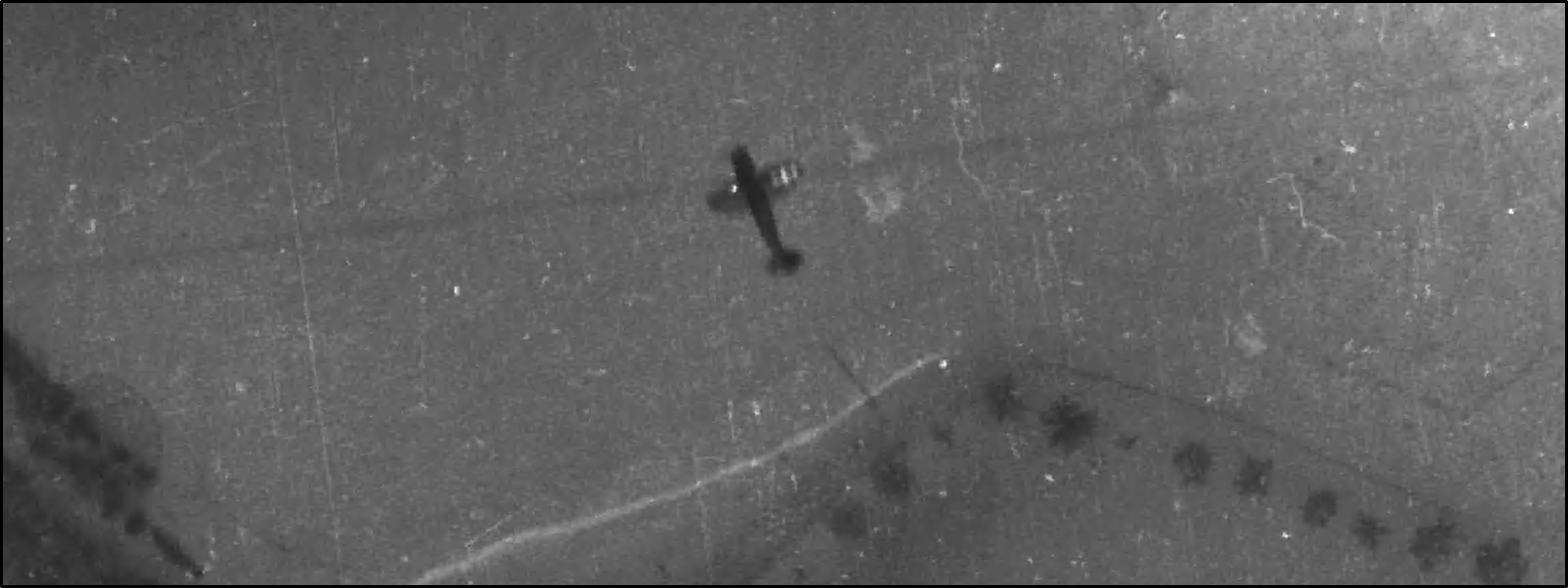
A rare spectacle, for example, is the photograph shown in Figure 1 of an aircraft flying at a lower altitude than the "camera aircraft", which was captured as "incidental equipment" in the course of the photographic reconnaissance. The star marking on the wing identifies it as a US aircraft. For the expert, the type of aircraft is also easily recognisable - it is a Republic P-47 Thunderbolt, a single-seat fighter aircraft of the USAAF, which was usually used as a low-flying aircraft in the context of tactical air attacks (this also explains the comparatively low altitude).
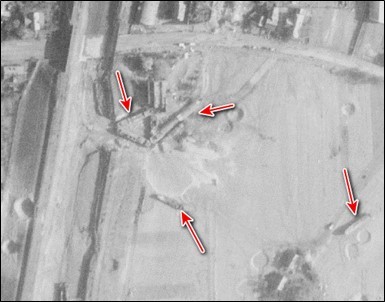
The next example (Figure 2) presents an initially confusing picture: cargo ships (marked in red) lie in the middle of a field criss-crossed with bomb craters?
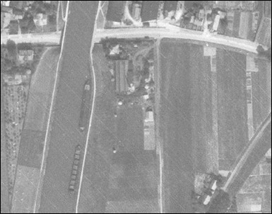
The solution to this "riddle" lies in a look back (see figure 3): The comparison with this older picture shows a canal in which several ships are visible (left in the picture). The canal was apparently damaged during an air raid, and the leaking water swept several ships away with it through the resulting opening. The freighters then came to rest in the adjacent fields (see Figure 2). This example clearly shows that in the case of initially "confusing" aerial photographs, a direct comparison with previous images often provides clarification. It once again demonstrates the necessity of multitemporal image viewing. Moreover, it reminds us of the fact that interactions between the environment and the effects of war can also take place.
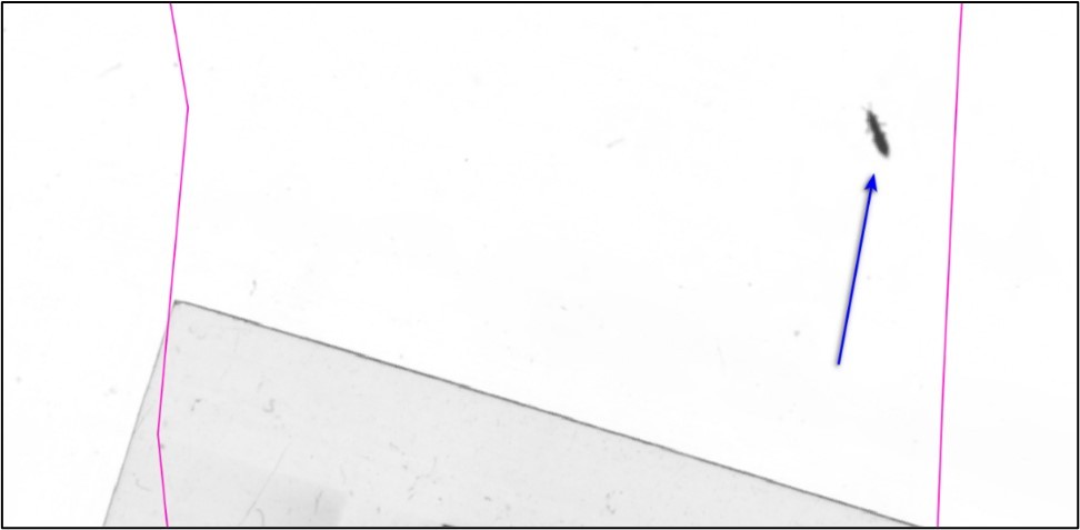
Sometimes the punchline of an aerial photograph is not in the photo itself, but on the edge. Here (see figure 4), a (presumably) unwanted guest was immortalised in the image during the reproduction (scan or copying process).
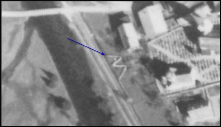
Another unusual structure with a clearly visible "zig-zag pattern" is shown in Figure 5. The basic shape initially shows a basic similarity with the frequently encountered cover ditches, which are usually also laid out in a "zig-zag" shape to improve their protective function. But in the present case - as the stereoscopic observation of the aerial photographs has shown - it is not a hollow but a solid shape; so perhaps a low wall instead? The experts of the aerial photo evaluation team came to the plausible conclusion that, taking into account the parameters of shape, structure, dimensions and proportions, the object in question is in all probability a conceivably harmless object - a clothesline! The photograph obviously shows the line attached in a space-saving "M-shape" with textiles such as clothes, blankets or sheets hung close together, which from the air initially appear to the observer as a kind of wall.
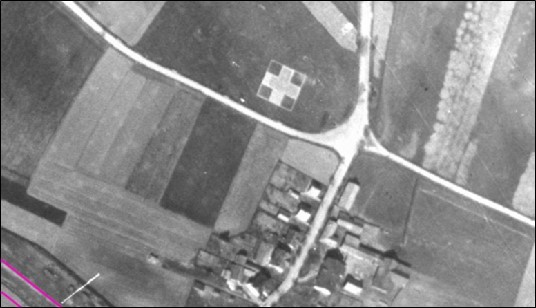
Finally, an example that makes it clear that even familiar structures can cause confusion in the aerial photograph - here (Figure 6) a large white cross placed on a field is visible. Red Cross symbols marked hospitals, hospital trains and similar medical facilities during the war to protect them from air raids. But in this case, no suitable facility could be researched in the vicinity, although the cross depicted is enormous in size (for a size comparison, consider the buildings in the immediate vicinity of the cross).
This leaves some room for speculation; the functional background of the cross cannot be determined on the basis of aerial photography alone. Nevertheless, we all know at the latest since the film Indiana Jones and the Last Crusade (1989): "Never before has a X somewhere, sometime marks a significant point".
Especially with this important wisdom in mind, it becomes clear that aerial photo interpretation is also detective work in which every clue is followed up. For every piece of the puzzle in the reconstruction of the events of the war helps to improve the basis for decision-making for the user.