Orienting investigation of two suspected drilling mud pit areas
Project details
CONTRACTOR:
LK ROTENBURG (WÜMME)
LOCATION:
GERMANY
BEGINNING CONSTRUCTION:
2018
BUILDING (PLAN):
2019
BUSINESS AREA:
ENVIRONMENTAL AND GEOTECHNICAL ENGINEERING
LOWER:
HANNOVER
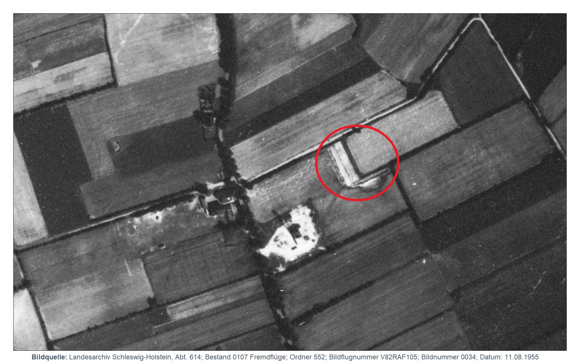
In the district of Rotenburg (Wümme), former drilling mud pits or suspected drilling mud pit areas are known. The M&P Ingenieurgesellschaft mbH was commissioned with the orienting investigation (OU) on the suspected sites Deepen and Scheeßel Z1.
The suspected drilling mud pit Deepen is located about 2.3 km north of the centre of Hemslingen, joint municipality of Bothel, district of Rotenburg (Wümme). The area is part of the Hemslinger Moor. In the six KRBs sunk in the northern part of the suspected site, the soil was sensorially inconspicuous. In one of the excavations, a brown, clayey silt layer of about 0.10 m thickness was found below the topsoil. Two groundwater samples were taken downstream of the suspected site. The chemical analyses did not reveal any significant pollutant levels in the topsoil and groundwater. However, elevated levels of long-chain CHCs and chloride were detected in the silt layer.
Thus, the presence of drilling mud in the investigation area has been confirmed in one borehole. It is recommended to spatially delimit the drilling mud deposits within the scope of a supplementary OU and to take a groundwater sample within the deposits in order to be able to conclusively assess the hazard potential.
The Scheeßel Z1 site is located about 1 km west of the centre of Hemslingen. Five boreholes up to a maximum depth of 7 m were drilled. In three of the boreholes, drilling mud was drilled underneath domestic waste deposits, which was very noticeable from a sensory point of view (aromatic odour). The drilling mud is located at depths between 2.90 and 4.35 m below ground level. The analyses confirm that the material is clearly contaminated with CHC and BTEX. The pollutant contents are clearly above the threshold for action. The groundwater is at a depth of approx. 10 m below ground level. It was examined in the upstream and downstream of the suspected site. However, no pollutant concentrations could be detected that could be attributed to the drilling mud deposits. The surface emission in the area of the drilling mud deposits was measured using a Lemberger box. Pollutants of the BTEX group could be detected, but only in low levels. Due to the dilution of the pollutants in the atmosphere, it is to be expected that the contents in the ambient air are clearly below the detection limit. It is noticeable that the levels of toluene in groundwater and in surface emissions are significantly higher than in the drilling mud. Toluene may also be of agricultural origin.
Overall, the suspicion that contaminated drilling mud is present at the suspected drilling mud pit Scheeßel Z1 has been confirmed. However, there is no risk to human health. In order to be able to conclusively assess the risk posed by the drilling mud to the groundwater as an object of protection, it is recommended that three quality measuring points be set up and sampled within the framework of monitoring. In addition to the suspected substances for drilling mud pits, agricultural parameters should also be investigated. Furthermore, soil gas measurements should be carried out both in the area of the drilling mud deposits and outside the suspected area. The aim of the further investigations is to distinguish between toluene from drilling muds and toluene from agricultural sources in the groundwater and in the soil air. Only then will a final assessment of the hazard potential of the drilling mud pit be possible.